
Walks
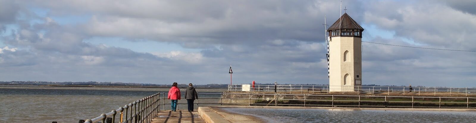
Brightlingsea is home to lots of wonderful walks, whether it’s a stroll along the beautiful promenade with its views of Mersea, Point Clear and the sea beyond, or circular walks that conveniently start and end at one of our great pubs! There are also a couple of great walks that start and end at the Museum and take you around the town to see Brightlingsea’s history first-hand; there’s one 2 miles/3.2km long and another at 3 miles/4.8km. You can find out more on these particular walks from the Museum.
The below routes have been submitted by local residents and if you click the maps you’ll be taken to the route on a website called Komoot, a free website & app which you can use to get and follow directions.
Walking routes…
A lap of Brightlingsea from the Promenade
I’ve put the start and end points at the Prom, but you could substitute that for many places along this route, just make sure you have enough time on the meter if using pay and display as this is a long one. But it’s worth it as you’ll do an entire lap of the town and will likely be rewarded with lots of wildlife on land, in the air and by the shore. See if you can spot the WW2 pillbox built as part of the town’s war defences on your way…

- Length: 15.6km
- Time to complete: 4:50
- Komoot summary: Intermediate. Easily-accessible paths. Suitable for all skill levels.
- Top tip: when crossing the main road, use the traffic island past the bus stop.
- Click here for route
National Nature Reserve circular walk
Starting and ending at the famous Bateman’s Tower, this route takes in the sea wall, mudflats, saltmarshes, Alresford Creek, sand and gravel pits, farmers fields and woodland. Depending on the season, you should be able to see: sea lavender, black-headed gulls, terns, ringed plovers and cormorants, avocet, redshank, black-tailed godwit and curlew. Also, oystercatcher, turnstone, and egret, among others. Along the route there are a number of plants listed in the Red Book of endangered species.

- Length: 9.4km
- Time to complete: 3:00
- Komoot summary: Intermediate. Easily-accessible paths. Suitable for all skill levels.
- Top tip: the path heading down past the water pumping station can get muddy.
- Click here for route
Short walk around town taking in some nature (and pubs)
You can start this route anywhere you like along its length, but I’m going from the High Street. At its most northernly point you can take some times to go through Springmead Gardens, then follow the route to the Lozenge and then along the rear of the caravan park until you reach some steps up to the old railway line. Coffee/bacon roll at Bateman’s Cafe then on to the Marina/Yachtsman for a pint.
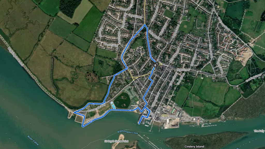
- Length: 4km
- Time to complete: 1:15
- Komoot summary: Easy. Great for any fitness level. Easily-accessible paths. Suitable for all skill levels.
- Top tip: there is a cut through the Marina at Fieldgate Dock/Waterside not shown on Komoot.
- Click here for route
Circular walk from Tower Street Car Park
You can substitute The Yachtsman for the start point, but this walk is a nice way to build up some appetite for lunch (or to walk it off afterwards), and you also have the option of stopping off at The Rosebud before the route drops down through the fields towards the end of the walk.
I like this walk because it takes in the famous Rope Walk (turn left at waypoint 4 if going right looks too muddy) and also the hidden gem which is Gravel Field.
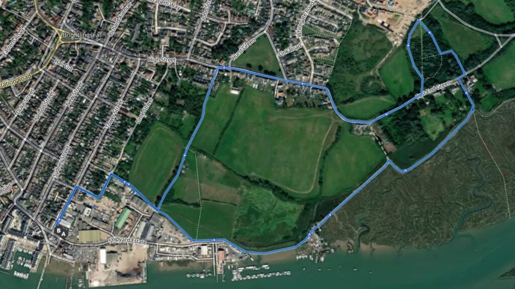
- Length: 3.7km
- Time to complete: 1:09
- Komoot summary: Easy hike. Great for any fitness level. Easily-accessible paths. Suitable for all skill levels.
- Top tip: a couple of points can get muddy if it’s rained recently.
- Click here for route
East Mersea circular walk
Take a trip on the foot ferry from Brightlingsea Harbour to Mersea Island and do this 7km walk taking in some lovely countryside, a nice pub (Dog & Pheasant), a lovely seafood eatery (Seafood at Dawn) and the beach (keep an eye out for the old WW2 defences). Just remember to give yourself enough time to catch the last ferry back!

- Length: 7.2km
- Time to complete: 2:11
- Komoot summary: Intermediate. Easily-accessible paths. Suitable for all skill levels.
- Top tip: book your ferry trip here.
- Click here for route
Point Clear circular walk
Hop on the Brightlingsea Harbour ferry to Point Clear and enjoy a 2km half hour ramble along the St Osyth Sea wall or the St Osyth/Point Clear Coastal 6km walk. Either one should be finished with a drink at the Ferryboat Inn or café on Point Clear, before returning to Brightlingsea. Perfect for dog walks and rambling groups. Maps and foot ferry timetable/ prices available from the Harbour office

- Length: 9.3km
- Time to complete: 2:50
- Komoot summary: Intermediate. Easily-accessible paths. Suitable for all skill levels.
- Top tip: book your ferry trip here.
- Click here for route
Round the Creek
We call this walk the ‘Round the Creek Walk’. Start from the hard area and go up Tower St & onto Lime Street and then when you see a dog waste bin turn right ont he footpath towards the Rope Walk. Along here you’ll have fields on your left and once you get past the boat storage yards, marshes and the creek on your right. Follow the path round to Mill Street, then the High Street and drop back down on to Lime Street and in total you’ll have 4000 steps under your belt.

- Length: 2.8km
- Time to complete: 0:55
- Komoot summary: Great for any fitness level. Easily-accessible paths. Suitable for all skill levels.
- Top tip: parking available at Tower Street Car Park
- Click here for route
You must be logged in to post a comment.